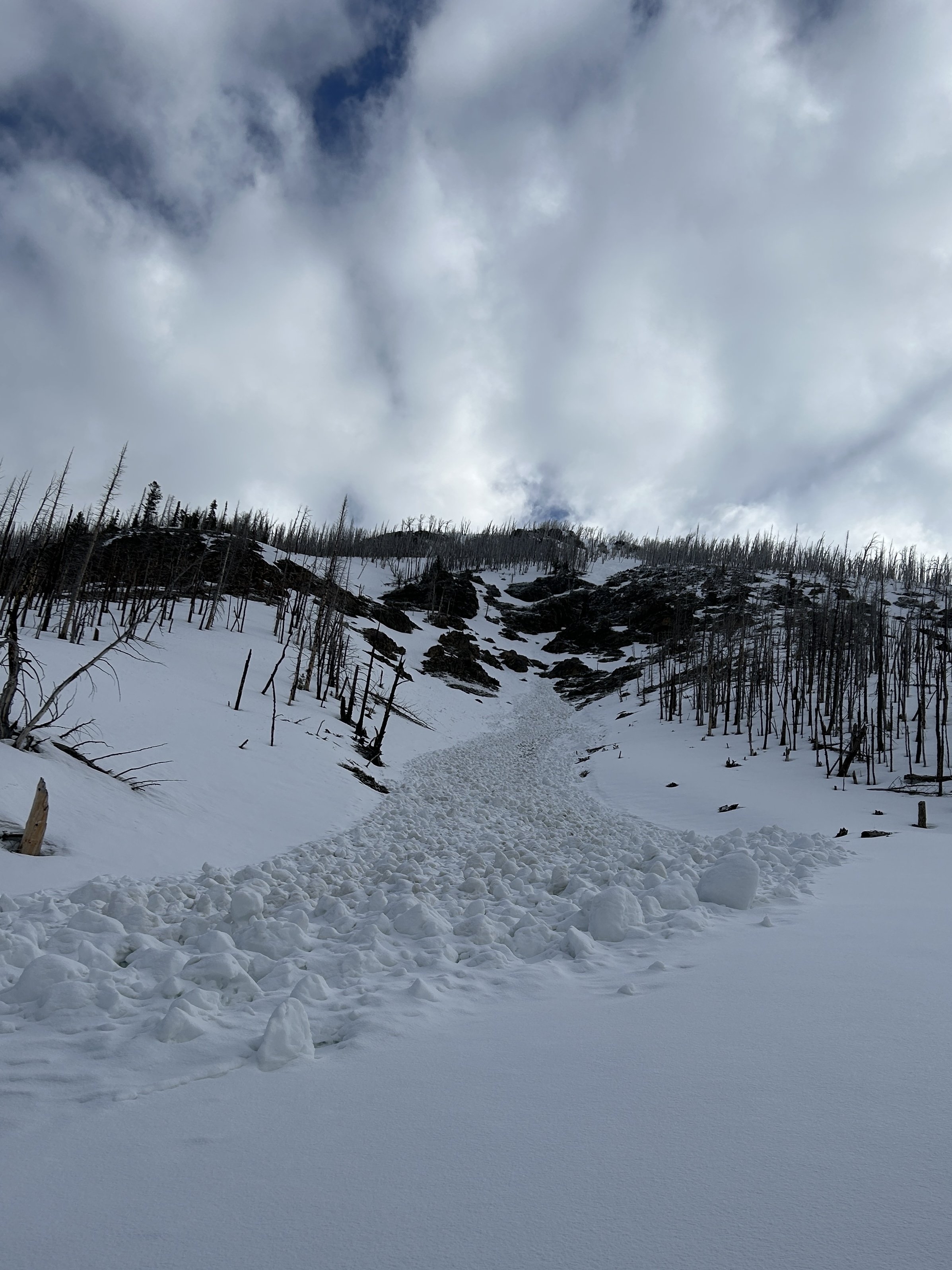
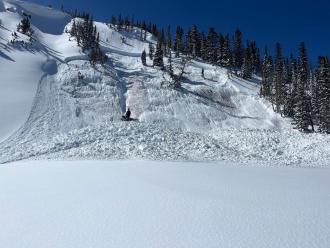
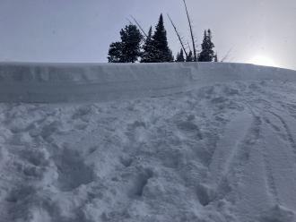
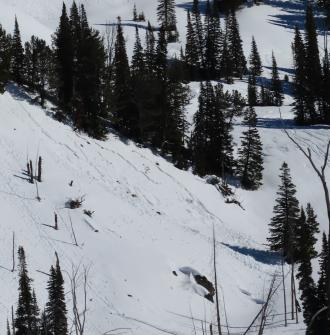
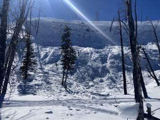
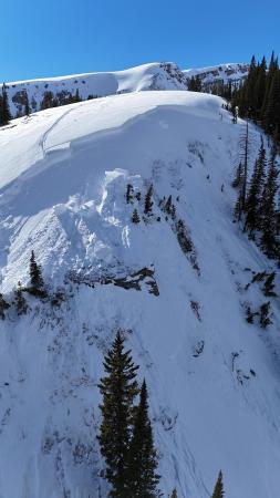
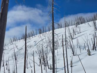
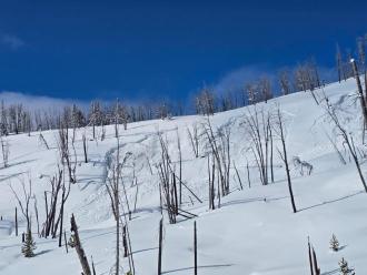
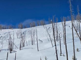
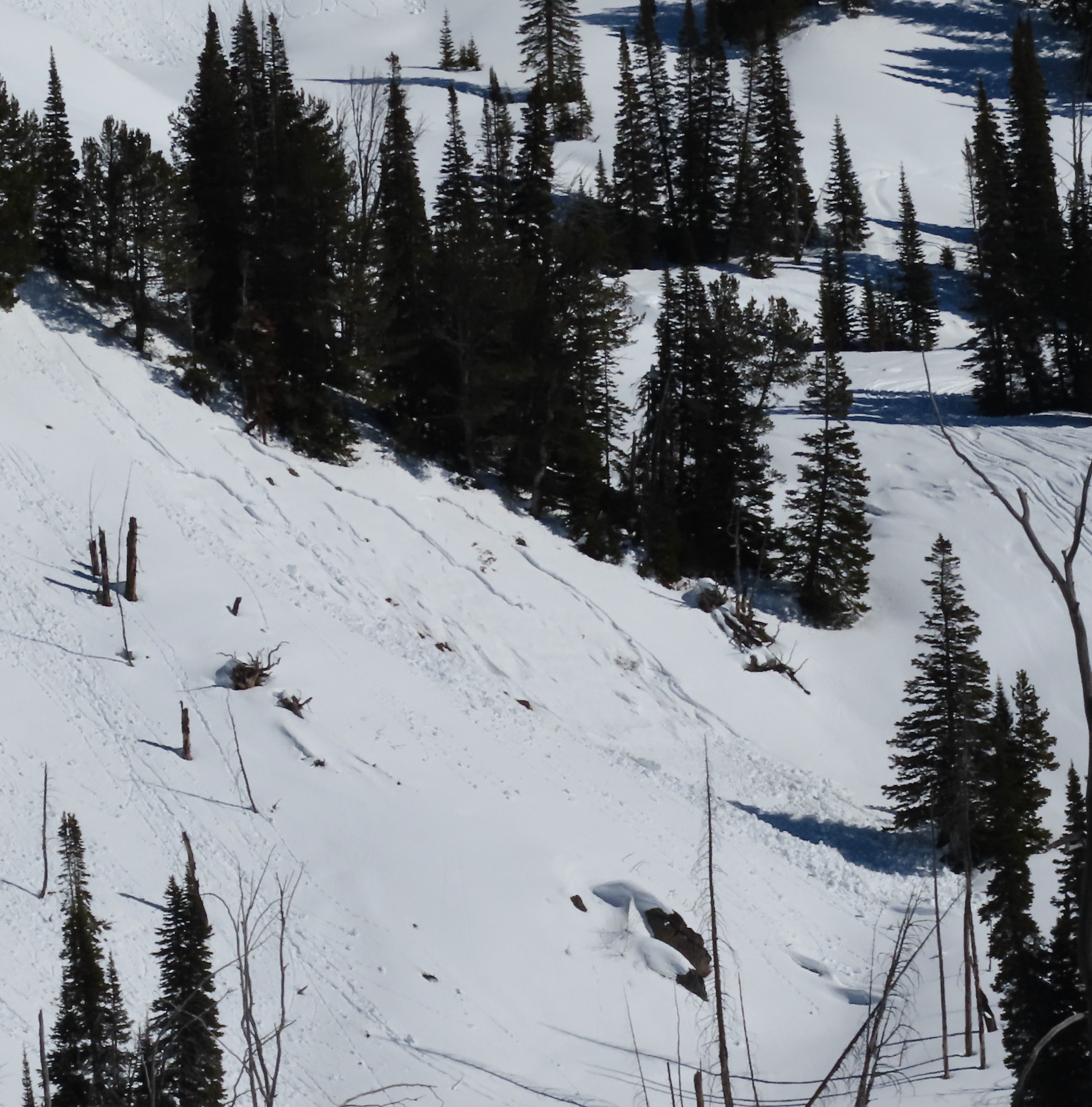
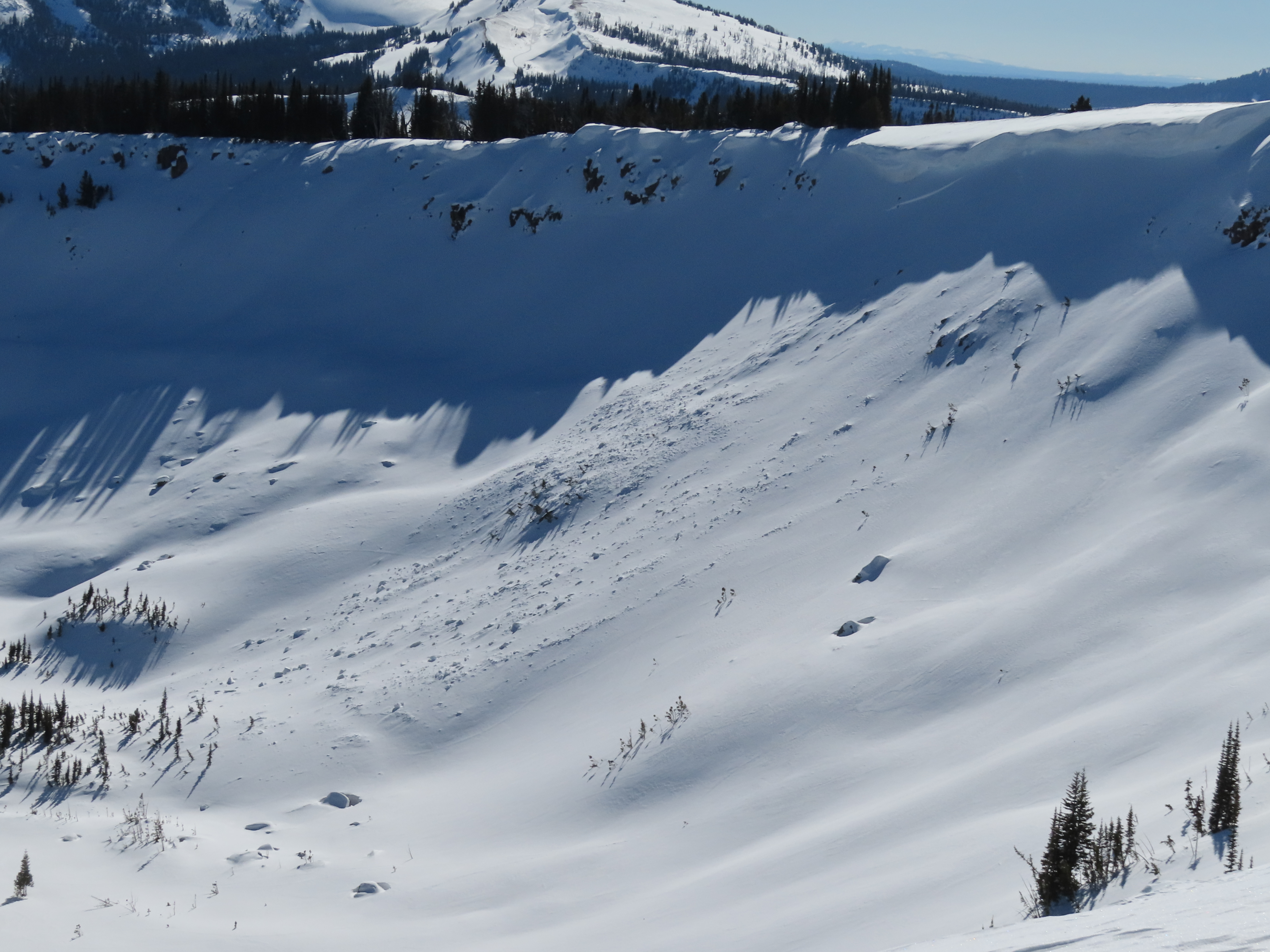
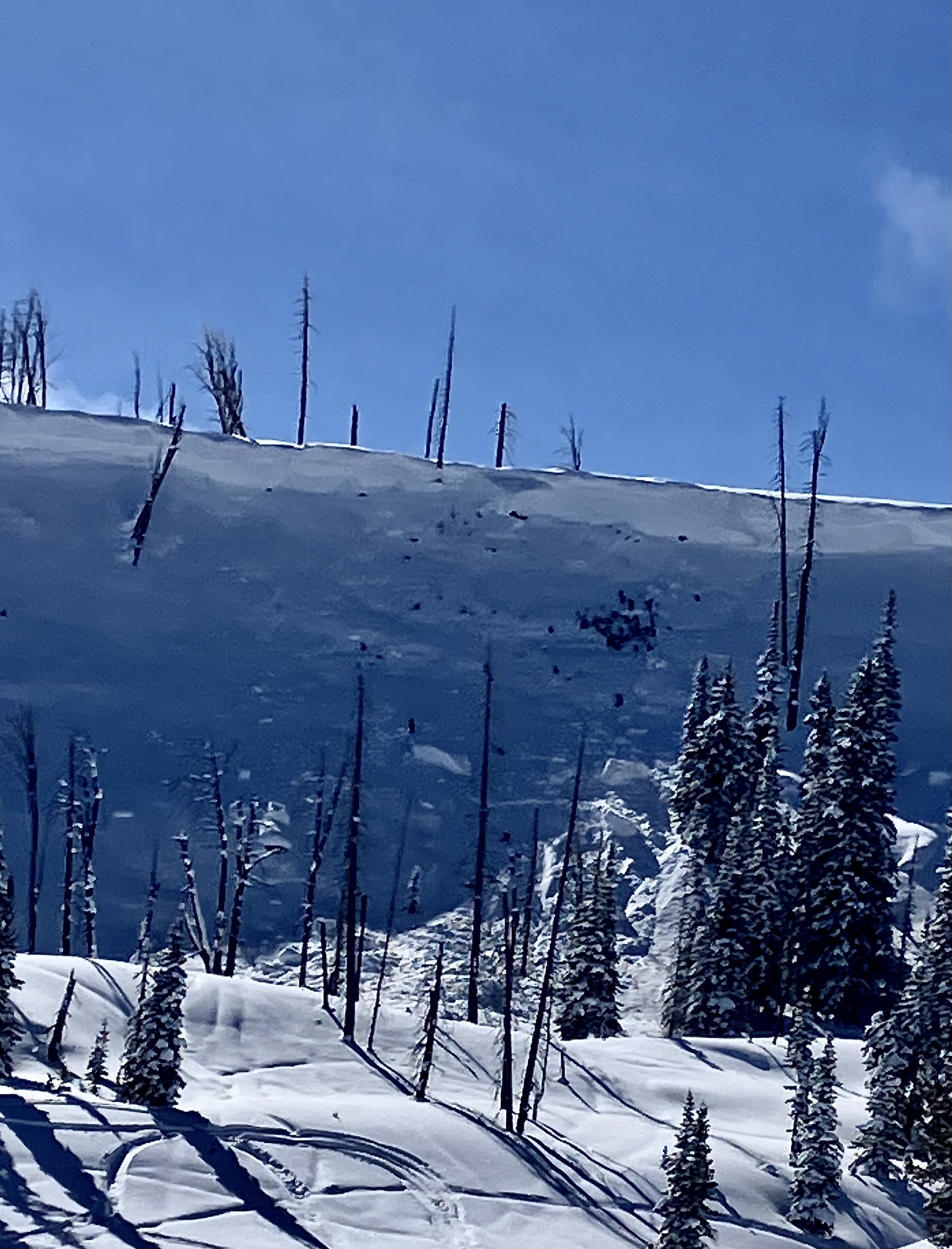
This wet loose avalanche is a great example of where they often occur. Rocks absorb extra heat from the sun and can quickly melt and destabilize the snow. Either move under areas like this early in the morning (as we did), or if you have to travel under them later in the day, move quickly.
Trip Planning for Southern Madison

Primary Problem: None
Bottom Line: Spring weather can be highly variable and create a mix of avalanche problems to watch out for. Snow conditions and snow stability can change drastically from day to day or hour to hour. Anticipate rapid change and plan accordingly. Plenty of snowfall over the winter with more spring snow to come makes avalanches possible into summer.Past 5 Days
Mon Apr 21

None
None
Fri Apr 25
None
None
Mon Apr 28
None
None
Fri May 2
None
None
Mon May 5
None
None
Relevant Photos
Displaying 1 - 40
-

-

Understanding Avalanche Safety Preparedness – 5-Minute Survey for Motorized Users
We need your input! Eastern Oregon University is conducting a survey to better understand avalanche safety preparedness among motorized backcountry users like you. Your feedback will help us learn more about who is purchasing and practicing with avalanche rescue gear (beacon, probe, shovel) and participating in avalanche education—and why some riders aren’t. The survey is confidential and anonymous.
Your feedback is invaluable in improving avalanche education and awareness. Please take a moment to share your experience and help us make a difference.
https://eoustmhs.qualtrics.com/jfe/form/SV_3L8QKAuZzcxJBLo
Thank you for your time and for being a part of this important effort!
-
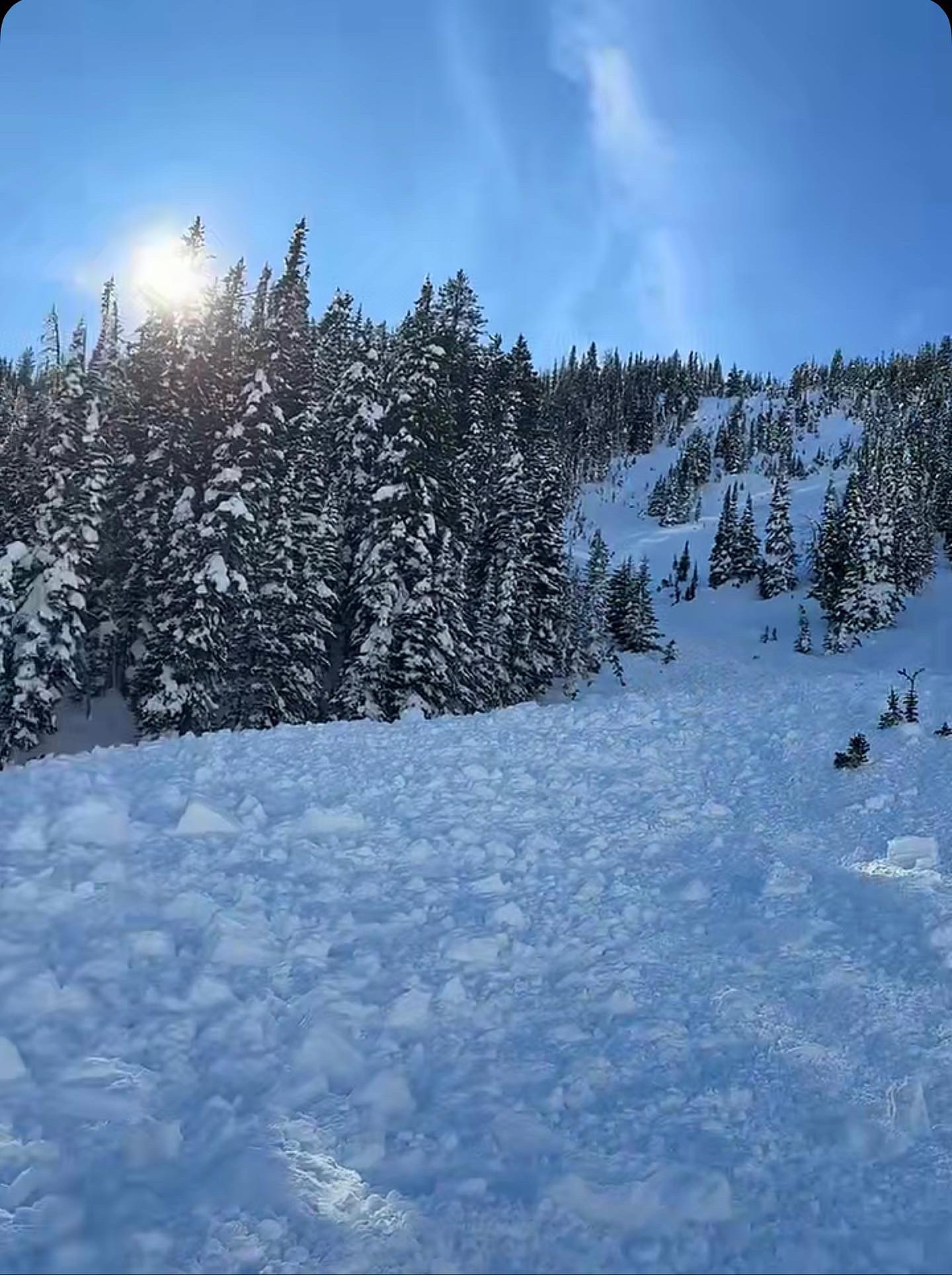
Snowmobile triggered slide in Taylor Fork today from above cutting across. Nobody caught. 2.5 feet deep 150 feet wide
-
Snowmobile triggered slide in Taylor Fork today from above cutting across. Nobody caught. 2.5 feet deep 150 feet wide
-
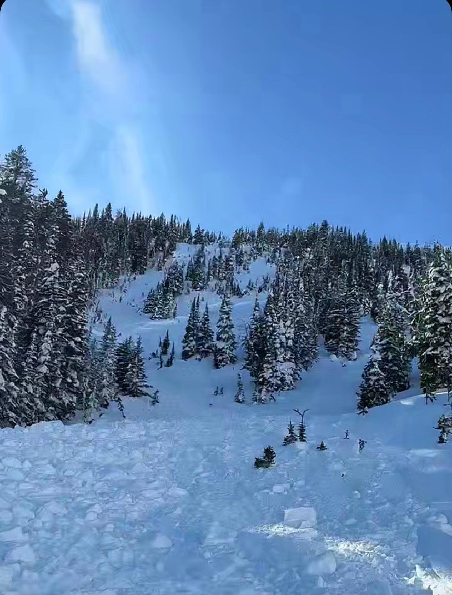
Persistent slab avalanche from (3/19) in Sunlight Basin, Taylor Fork. Photo: Anonymous
-
Persistent slab avalanche from (3/19) in Sunlight Basin, Taylor Fork. Photo: Anonymous
-
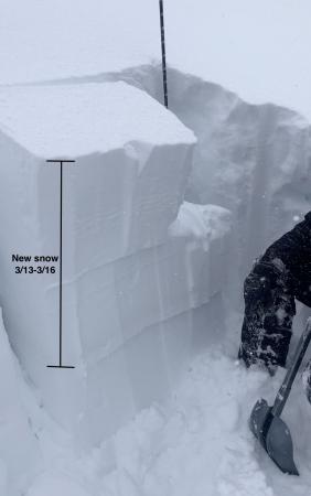
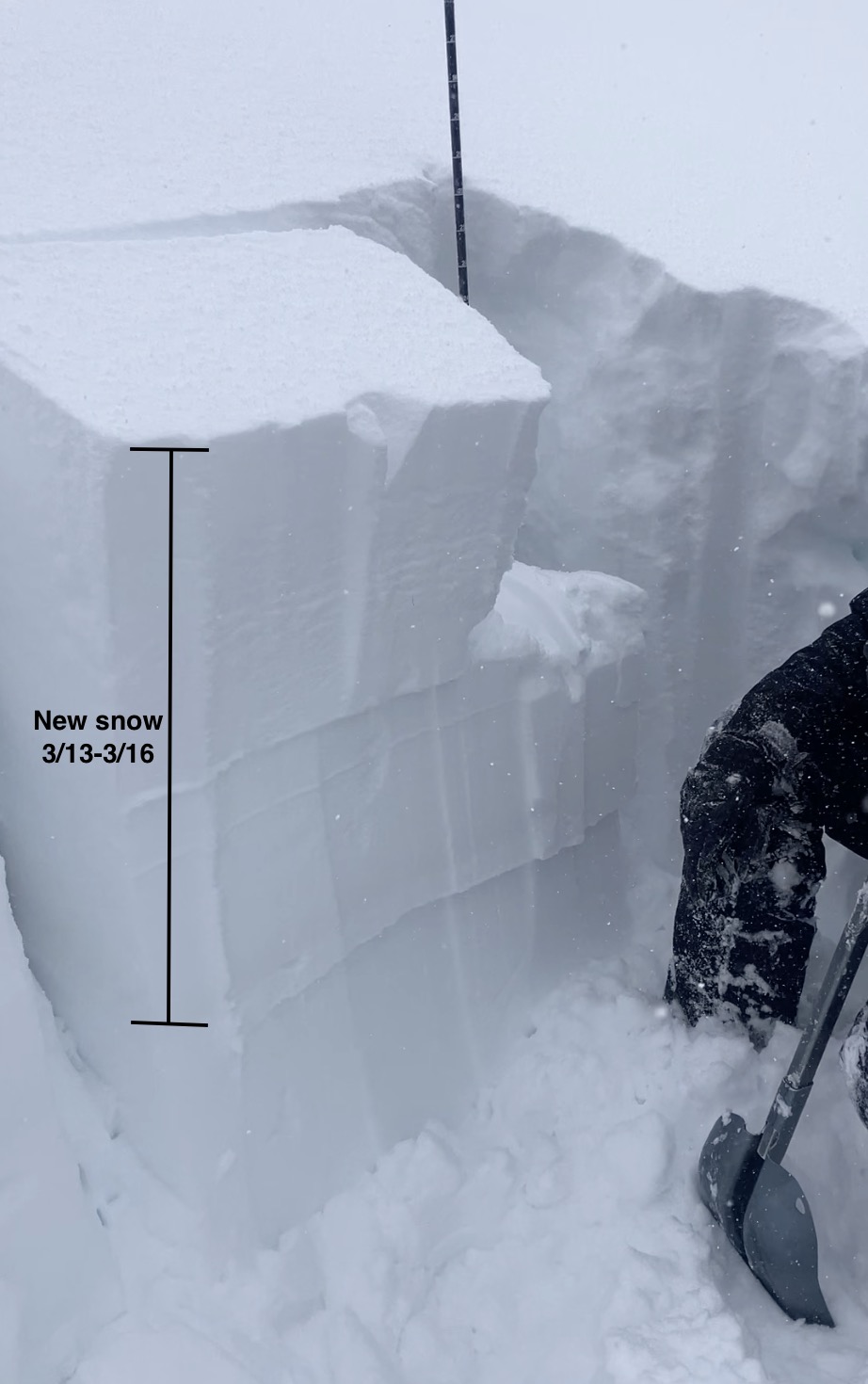
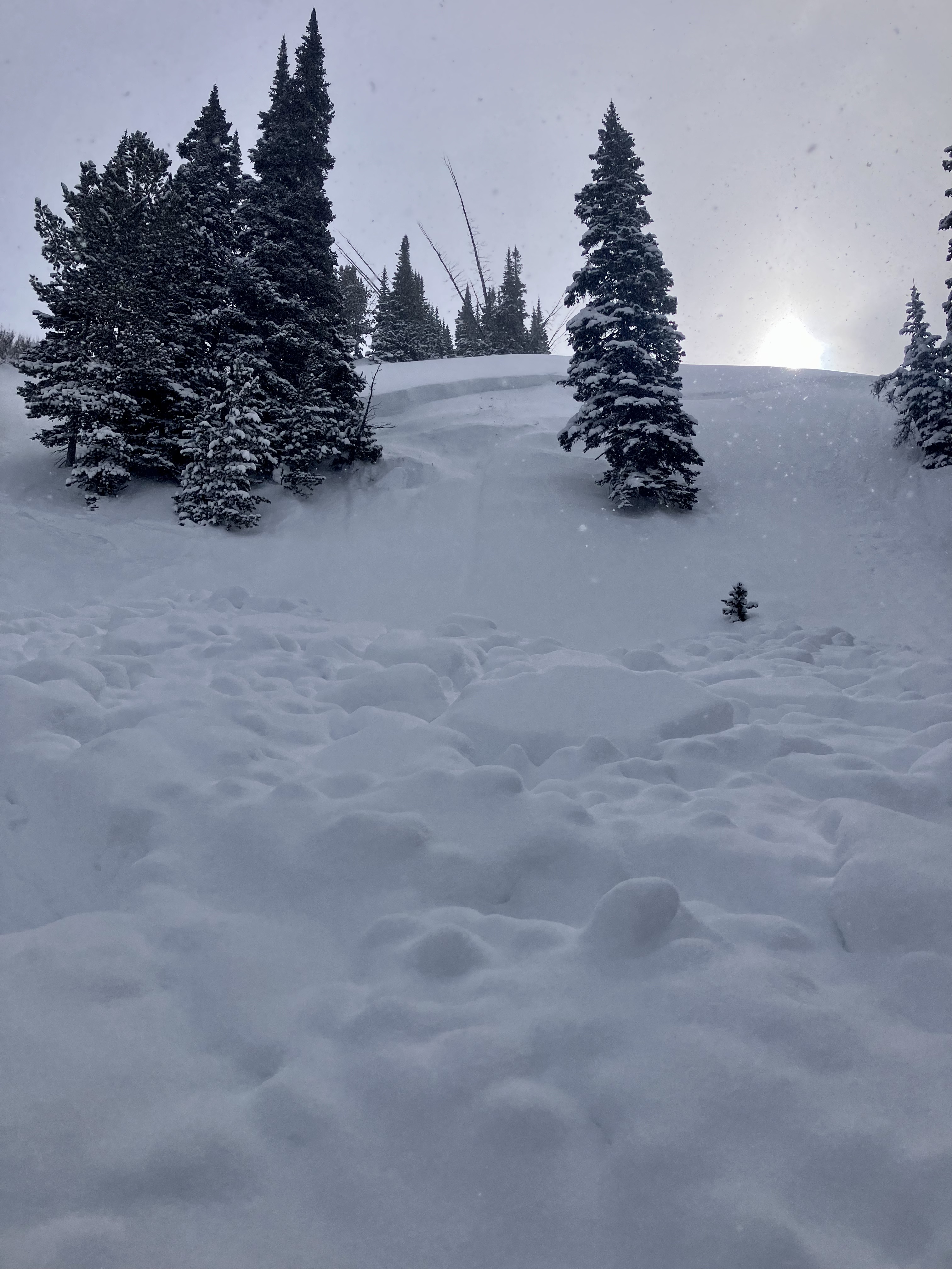
We rode into Tepee Basin and to the north wilderness boundary. There was 1.5-2 feet of new snow that fell since Thursday. We dug (3) snowpits on northeast, north and southeast slopes, between 8800'-9200'. The pits on northerly slopes had ECTP 17 and 22 on a thin weak layer below the new snow. We also had ECTP 6 within the storm snow. Photo: GNFAC
-
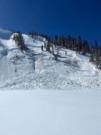
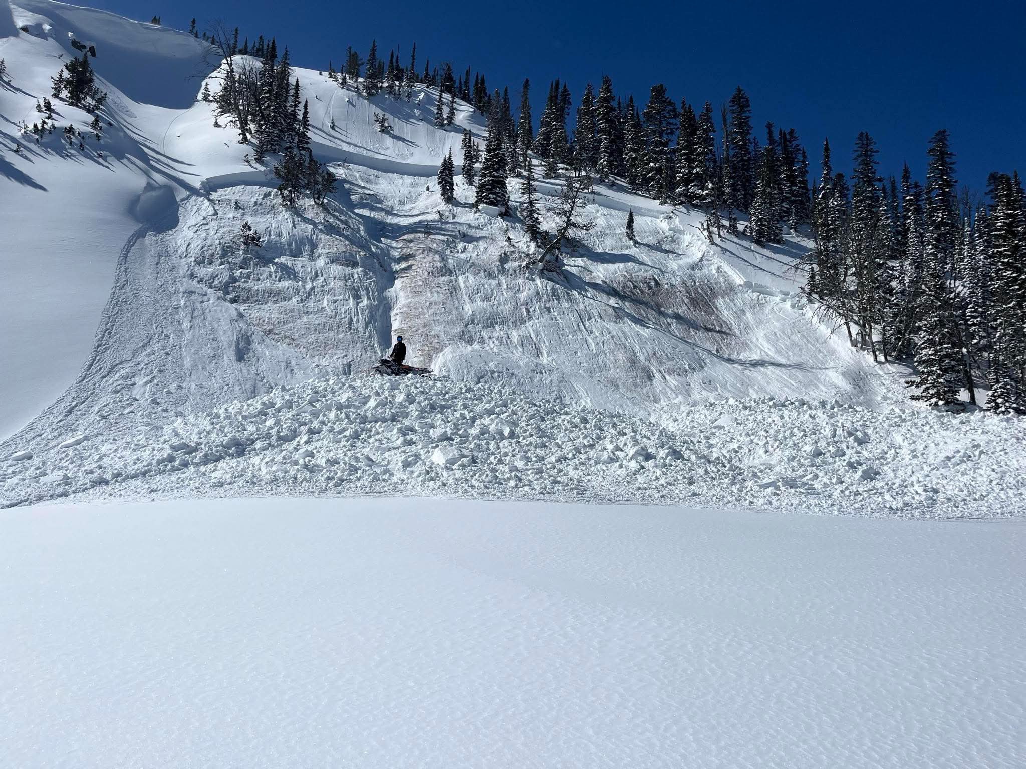
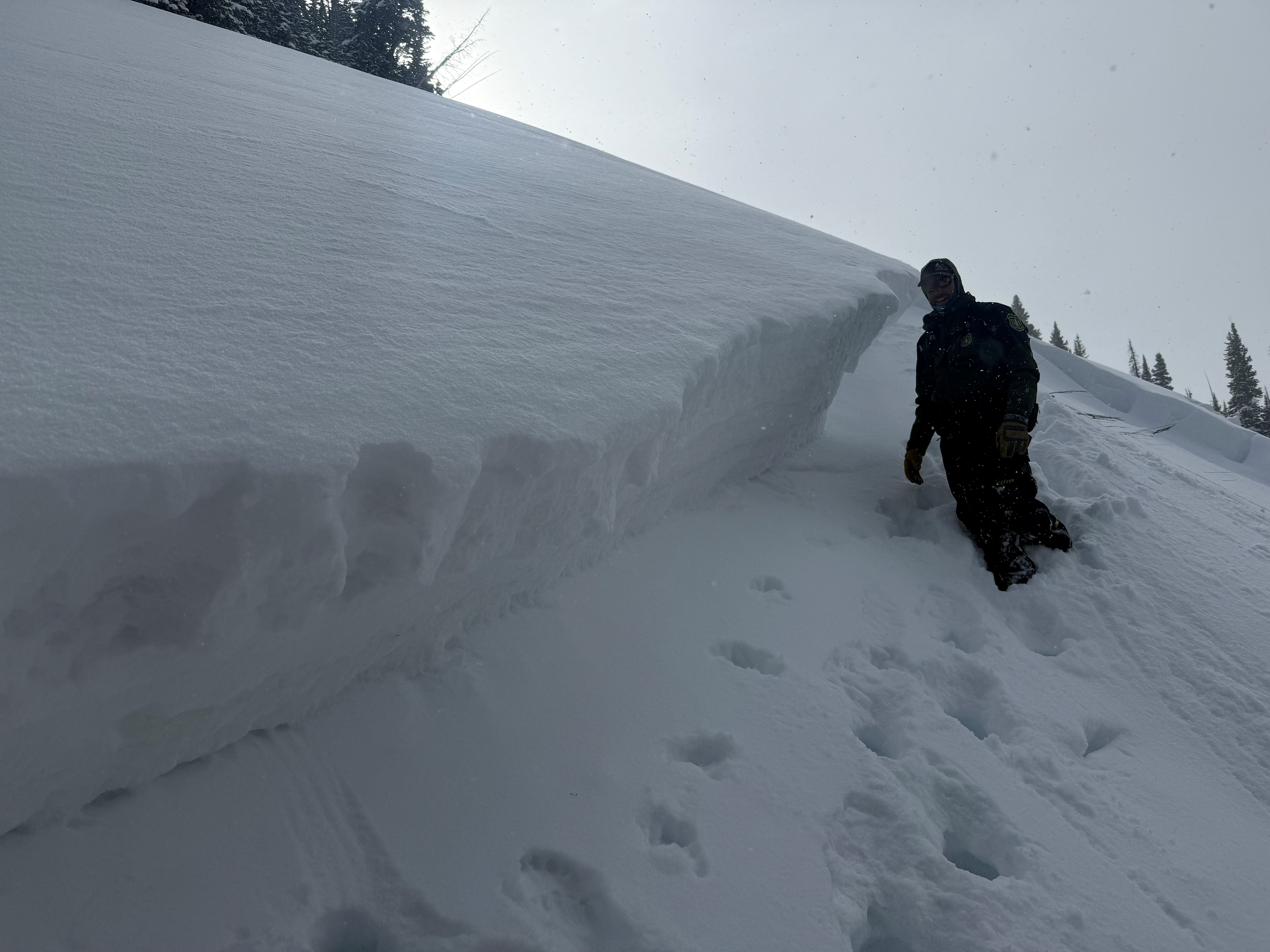
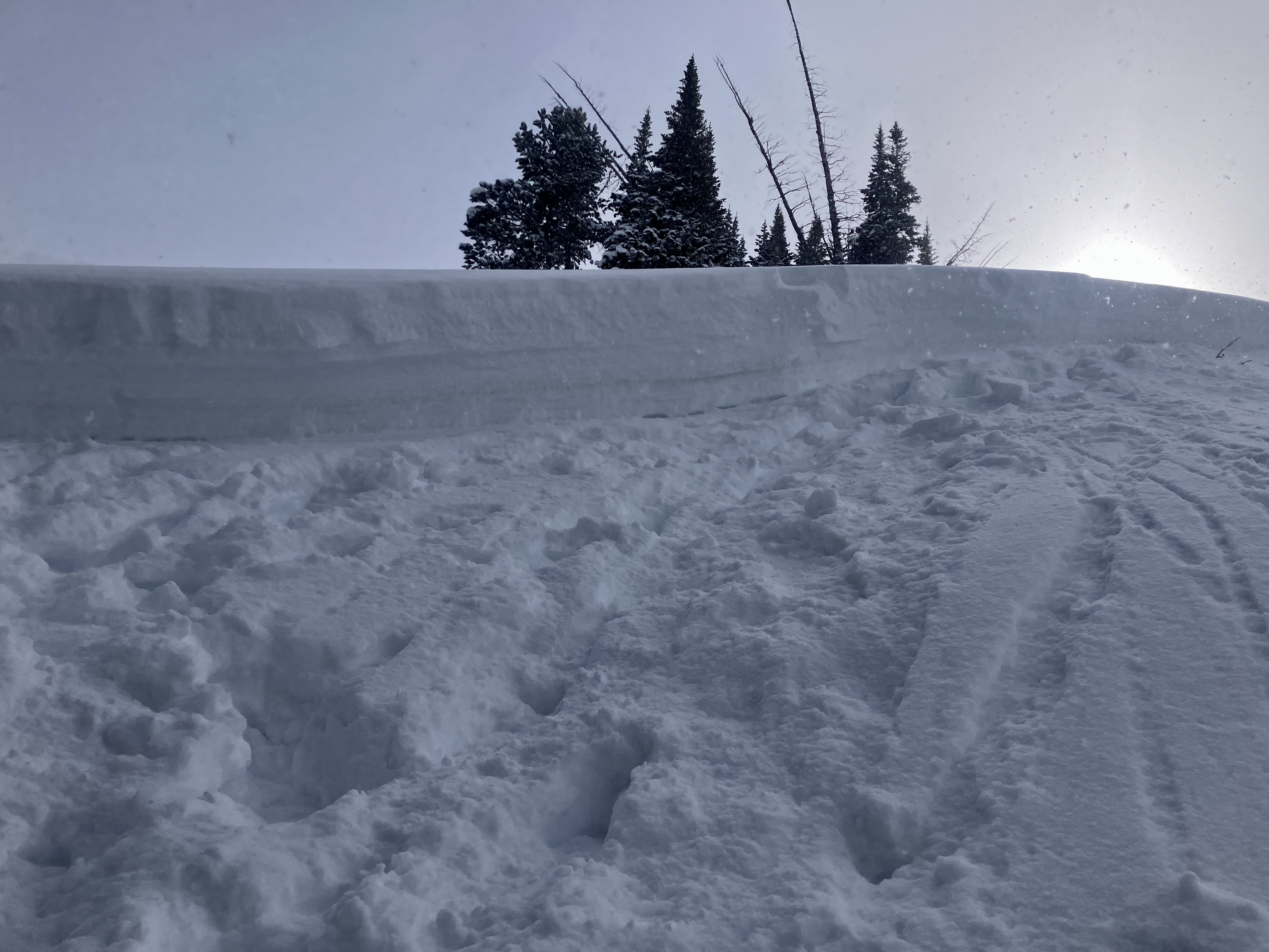
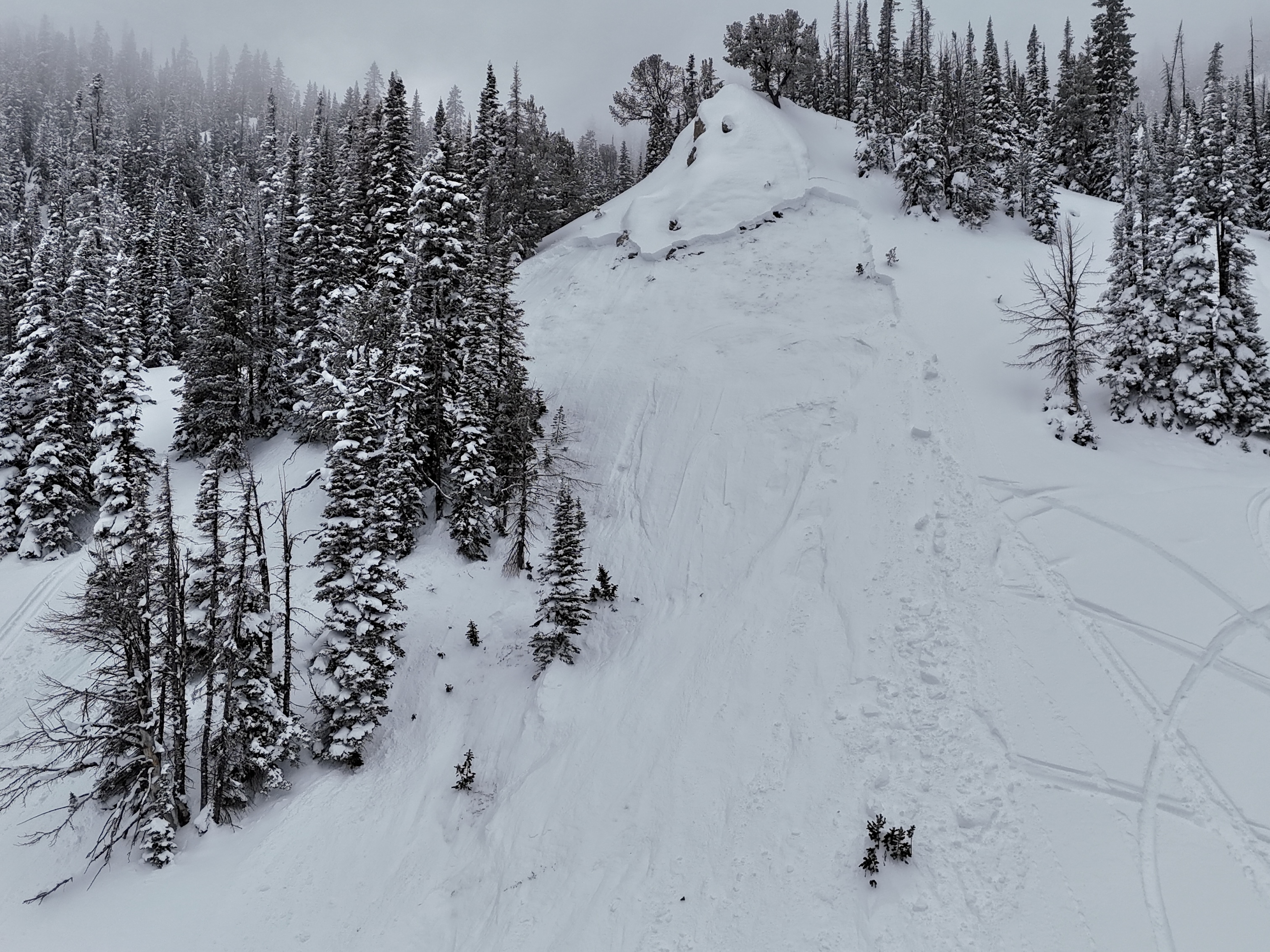
On March 15 We looked at the avalanche in Sunlight Basin/Taylor Fork that was triggered by a snowmobiler yesterday (Mar 14). It was 50' wide, 100' vertical, 2-3' deep hard slab with 8-9" new snow on top. Broke on weak facets buried in late January. Dirt layer from Feb 4 was visible 6-8" above weak layer. Bed surface was 3" to 1.5' deep of weak, sugary facets. Slope angle was 38-40+ degrees. 8800', WNW aspect. Photo: GNFAC
-
On Mar 14 A group of riders shared that they had triggered a 4' deep slide in a small pocket in Sunlight Basin of the Taylor Fork area. It was in an area with a relatively shallower snowpack, and broke on weak snow near the bottom of the snowpack. The rider that triggered it was going uphill and got stuck shortly after and noted the snowpack was much deeper there.
-

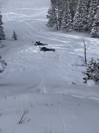
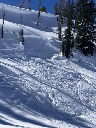
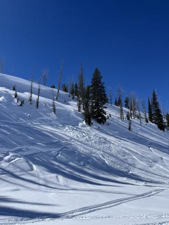
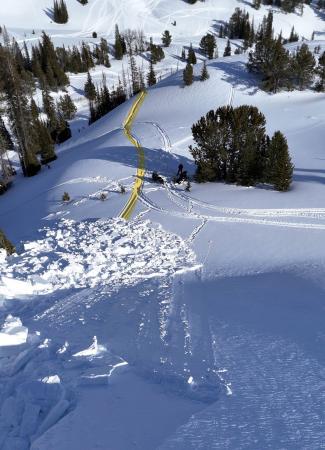
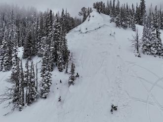
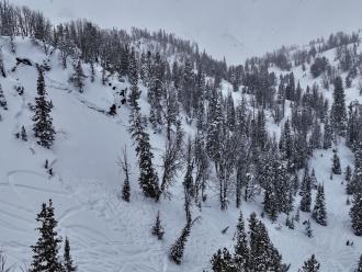
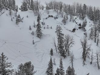
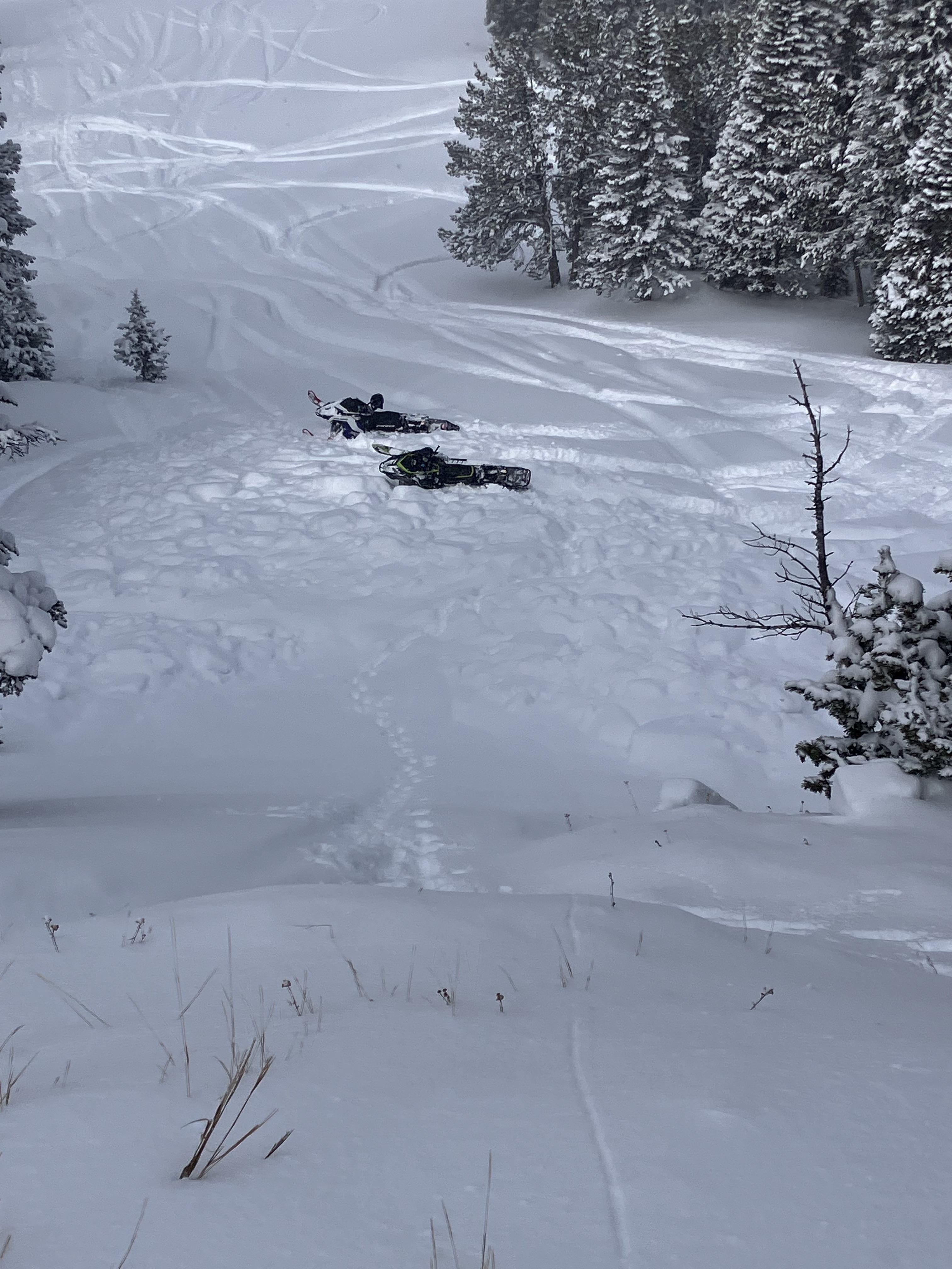
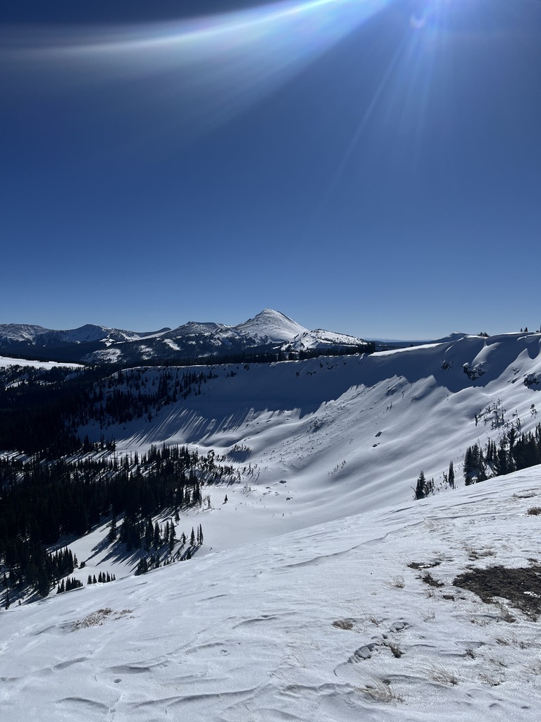
Another day of warm temps and clear skies allowed us to cover a lot of ground in the Southern Madisons. We rode into the Taylor Fork, up to the weather station, to the top of Carrot Basin, through Sage Basin, up and over into Cabin Creek, and all the way up to the head of Red Canyon.
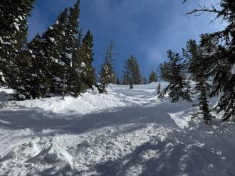
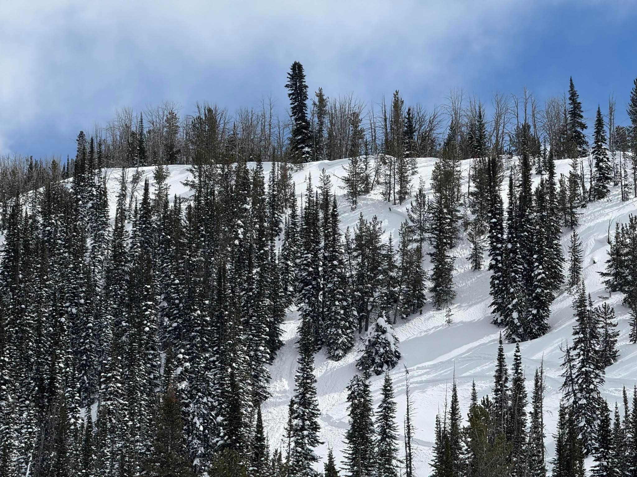
There were a handful of small wet-loose avalanches on solar aspects that we noted throughout the day. While northerly aspects stayed cold, solar aspects became wet a couple inches down. Photo: GNFAC
-
Another day of warm temps and clear skies allowed us to cover a lot of ground in the Southern Madisons. We rode into the Taylor Fork, up to the weather station, to the top of Carrot Basin, through Sage Basin, up and over into Cabin Creek, and all the way up to the head of Red Canyon.
There were a handful of small wet-loose avalanches on solar aspects that we noted throughout the day. While northerly aspects stayed cold, solar aspects became wet a couple inches down. Photo: GNFAC
-
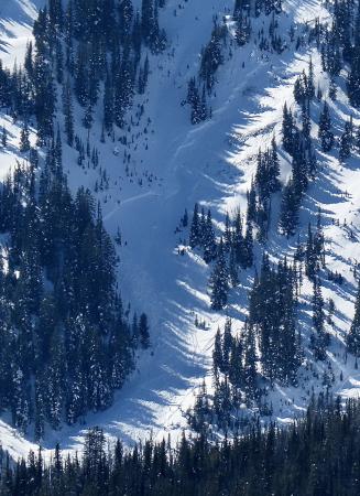
Photo taken Mar 1 by GNFAC
-
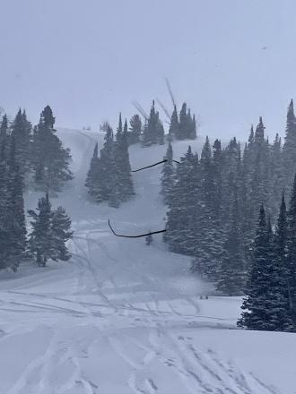
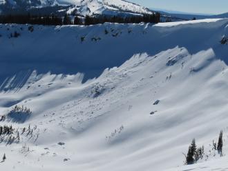
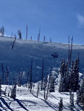
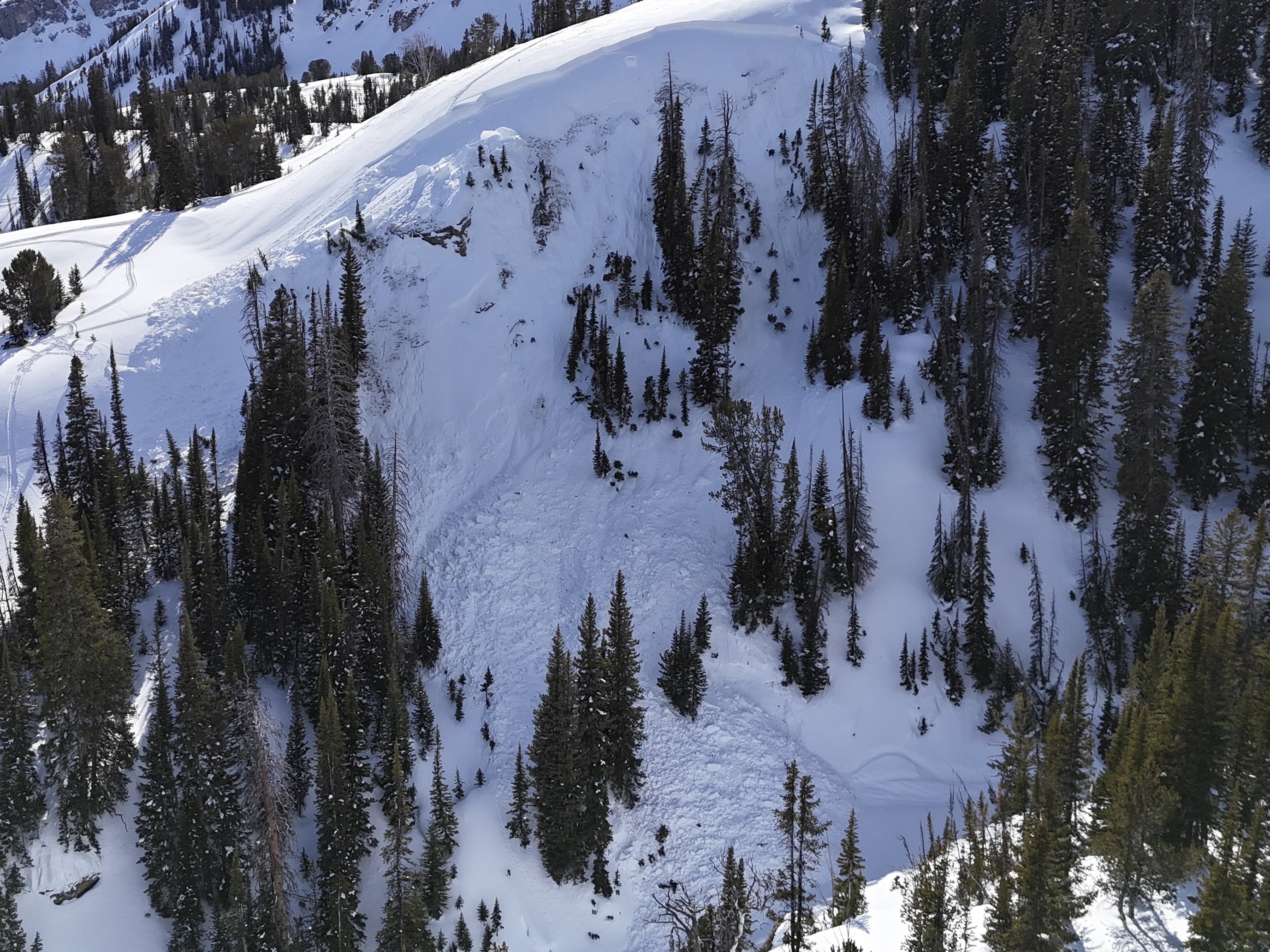
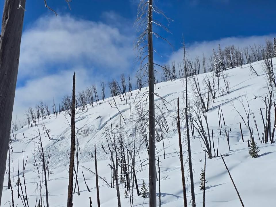
We also spotted an old wind slab avalanche (R1-D2) that broke earlier this week in Sunlight Basin. Photo: GNFAC
-
On Mar 1 we also spotted one older cornice-fall triggered avalanche in Sunlight Basin. Photo: GNFAC
-

On Mar 1 we also spotted two cornice-fall triggered (R2-D2) avalanches that broke earlier this week - one in Sunlight Basin and one in Sage Basin. Photo: GNFAC
-
On Mar 1 We also spotted one cornice-fall triggered (R2-D2) avalanche that broke earlier this week in Sage Basin. Photo: GNFAC
-
At the top of Carrot Basin, we saw a small avalanche (R1-D1) on a N aspect that likely broke yesterday on buried weak layers. Photo: GNFAC
-
At the top of Carrot Basin, we saw a small avalanche (R1-D1) on a N aspect that likely broke yesterday on buried weak layers. Photo: GNFAC
-
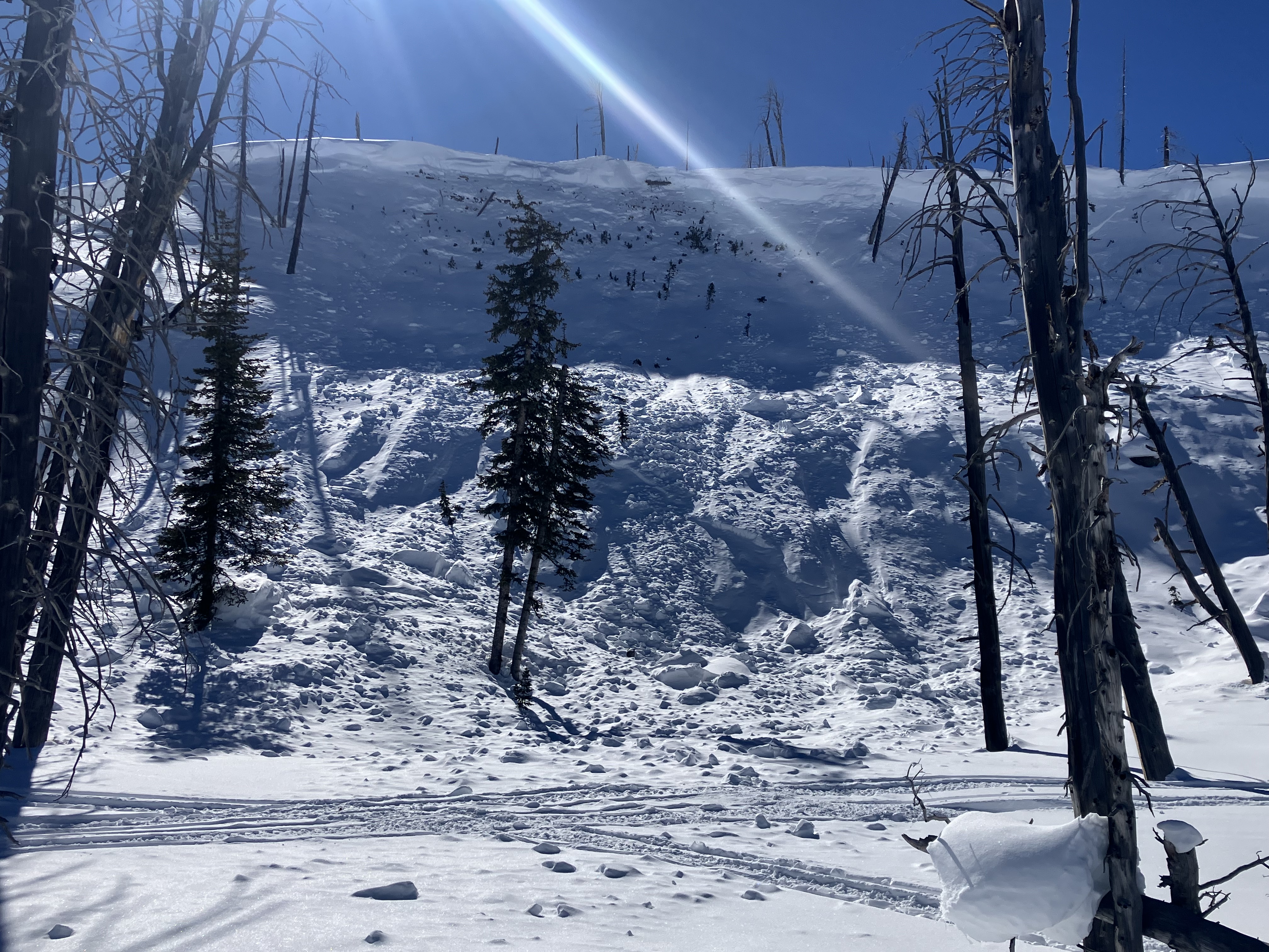
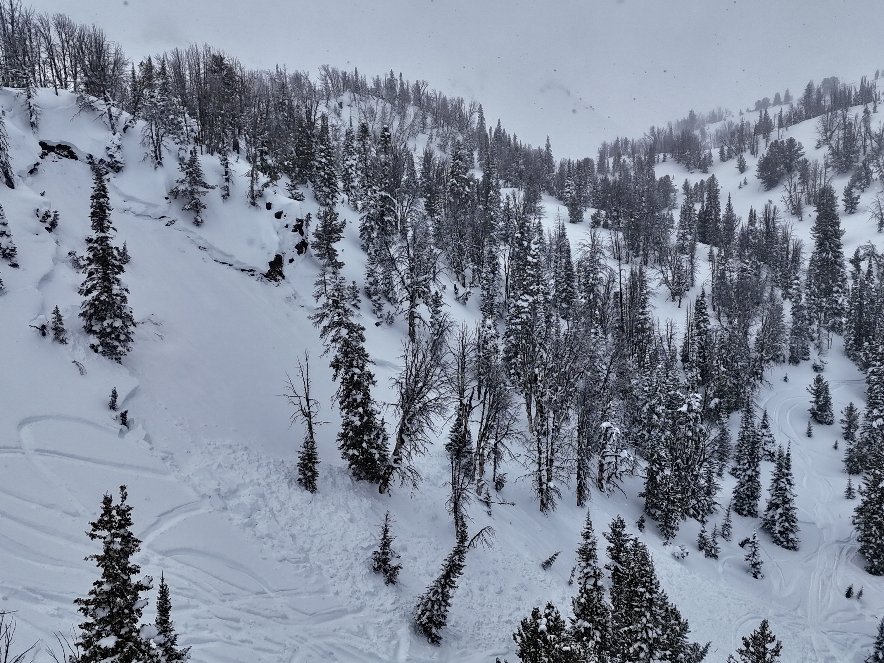
A rider triggered a huge avalanche in the uppermost reaches of Targhee creek on a north facing slope at 9200'
-
A rider triggered a huge avalanche in the uppermost reaches of Targhee creek on a north facing slope at 9200'
-
A rider triggered a huge avalanche in the uppermost reaches of Targhee creek on a north facing slope at 9200'
-
From IG message: "Getting word that a group triggered a decent slide today out at cabin creek. I’ll attach the coordinates to the general area, to the best of my knowledge.
44.86484, -111.22023No burials. They were able to outride if. But thought I’d send coordinates in case you guys were gonna be in the area and wanted to check it out."
-
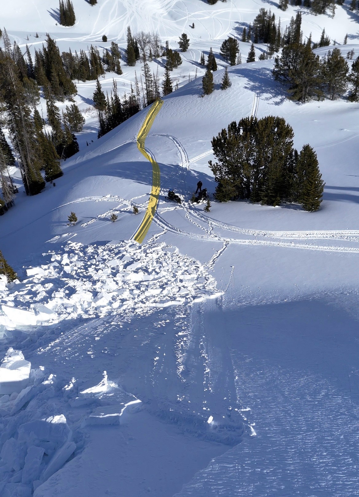
Snowmobile triggered avalanche likely on Saturday, Feb 22. It appeared that no one was caught or buried.
-
Snowmobile triggered avalanche that resulted in a partial burial with no injuries on Friday, Feb 21.
-
Snowmobile triggered avalanche that resulted in a partial burial with no injuries on Friday, Feb 21.
-
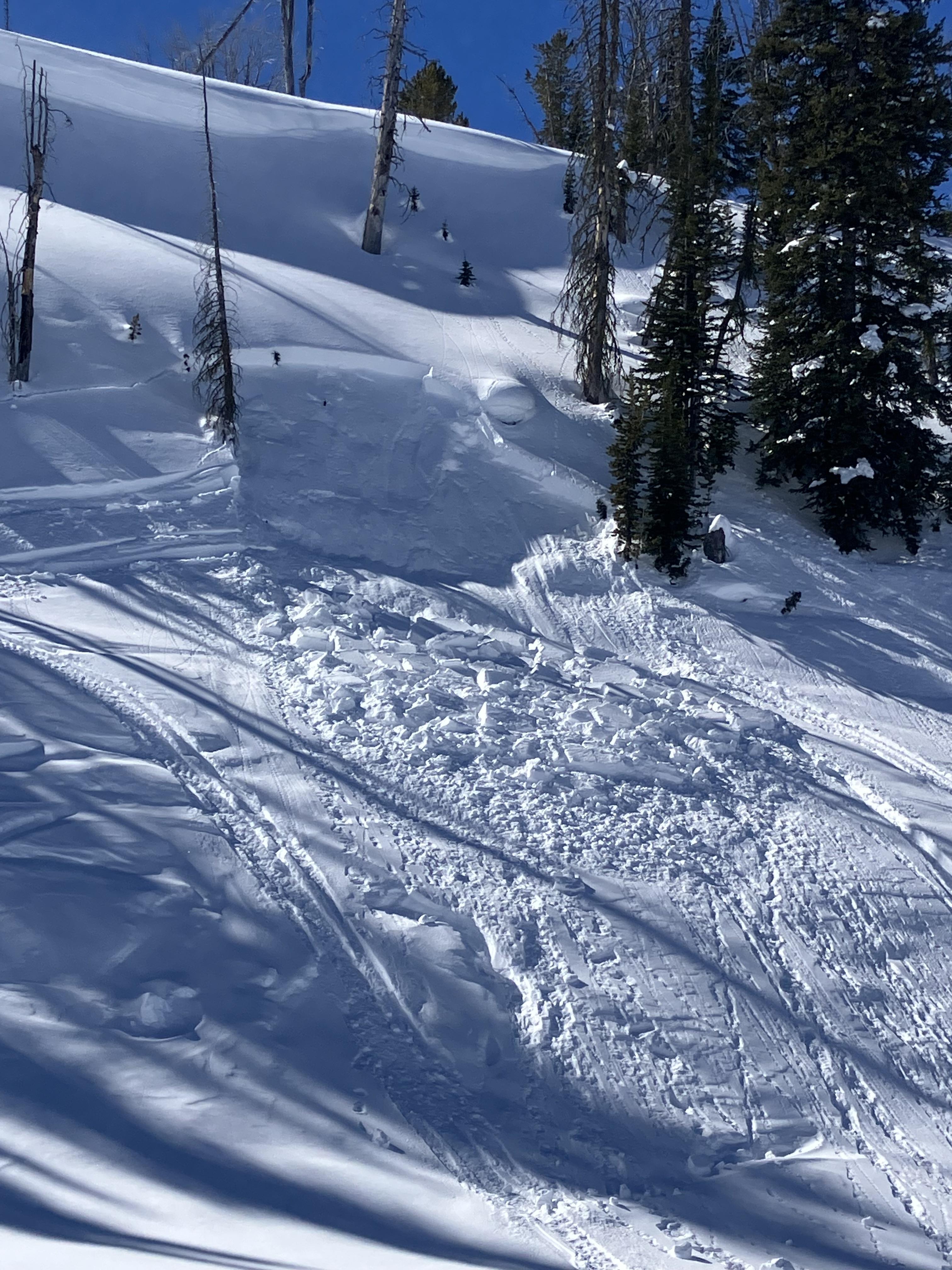
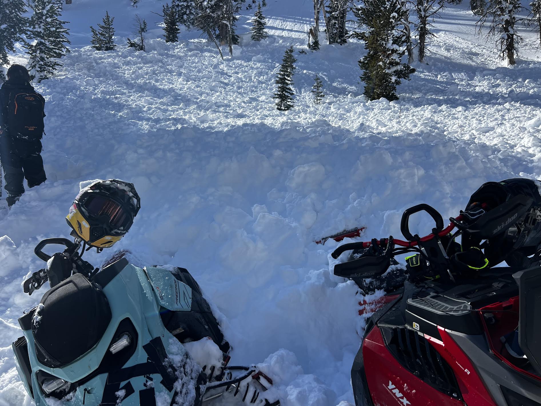
From IG message: "We remotely triggered this hillside in Taylor's fork yesterday [2/21] from the Ridgeline above it. We were looking for a safe spot to drop down when it released below us. Circled around for some pictures. The snow was pretty shallow, only 2-3 feet deep, and slid to the ground. South facing slope"
-
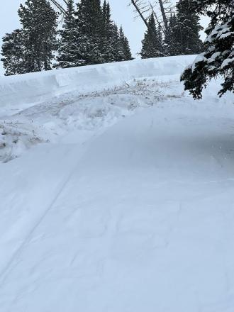
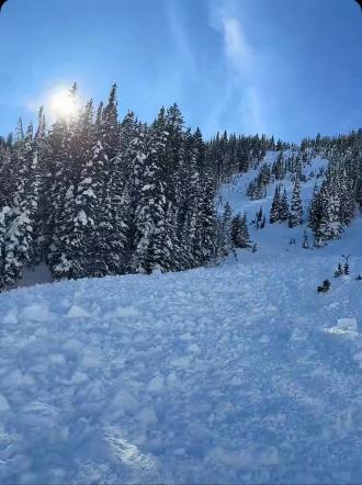
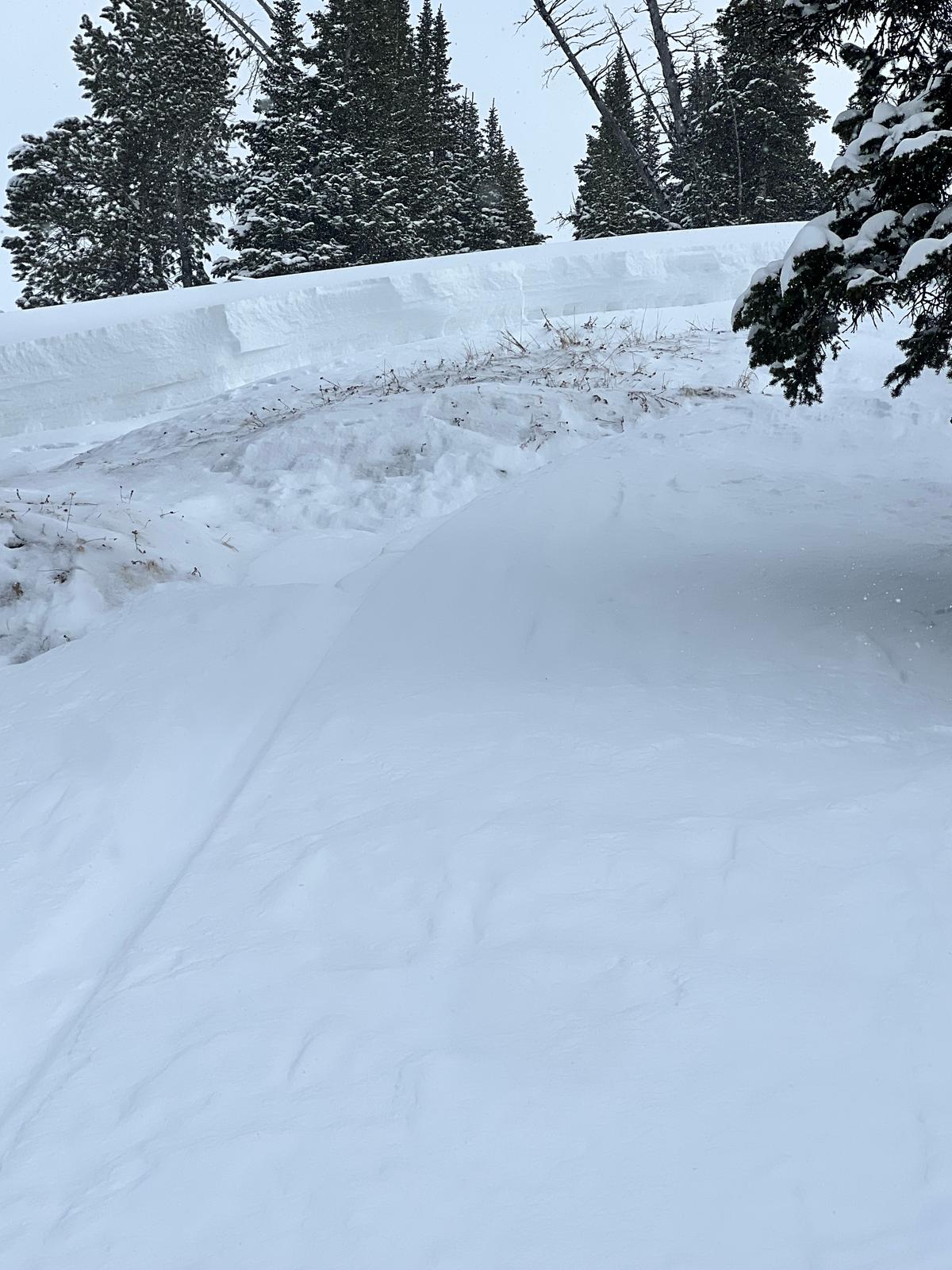
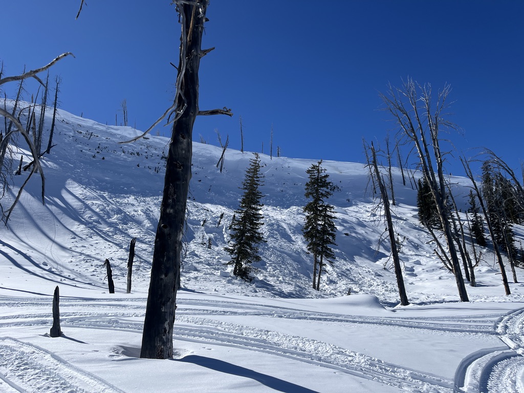
There was a thin melt/freeze crust formed on solar aspects lower down (up to ~500 feet above the parking). Photo: BP
-
From email: "One of my crew was partially buried in an avalanche today(head about 1’ down, leg and arm still above snow) at approximately 13:10 hrs. Slope was greater than 35 degrees, crown approximately 85 yards wide, over 3’ at its thickest point. I believe it was a NE exposure with wind loading at the top. I had a bad feeling about this slope and mentioned it to my crew and avoided riding on it until one rider ran out of gas and I had to help him. Upon completion of task, I rode back to a spot that wasn’t as safe a vantage point as what I had previously stayed at, but the intention was we were all on our way out. So I parked and within 30 seconds, I hear my friend yelling behind me. I turn and immediately think “oh he’s about to hit us”. So, I attempted to start up my sled, to no avail While watching behind me. Suddenly, a massive “snow cloud” appeared about 30 yards above him and it took about 2-4 seconds to register that it was an avalanche and not another rider careening out of control at us. By that time, it was too late to do anything. The avalanche had reached the back of my friend and my sled, pushing us forward about 6 feet at 3-4mph. After it stopped, I assessed 3 of four of our team was accounted for, and one (the one who yelled at us) was not. He was partially buried by the front of the avalanche much like our sleds were. Fortunately, within 5 seconds, I saw an arm and a leg sticking out of the snow and we had his airway and head cleared within about 20 seconds. He was located approximately 10 yards from us. "
-

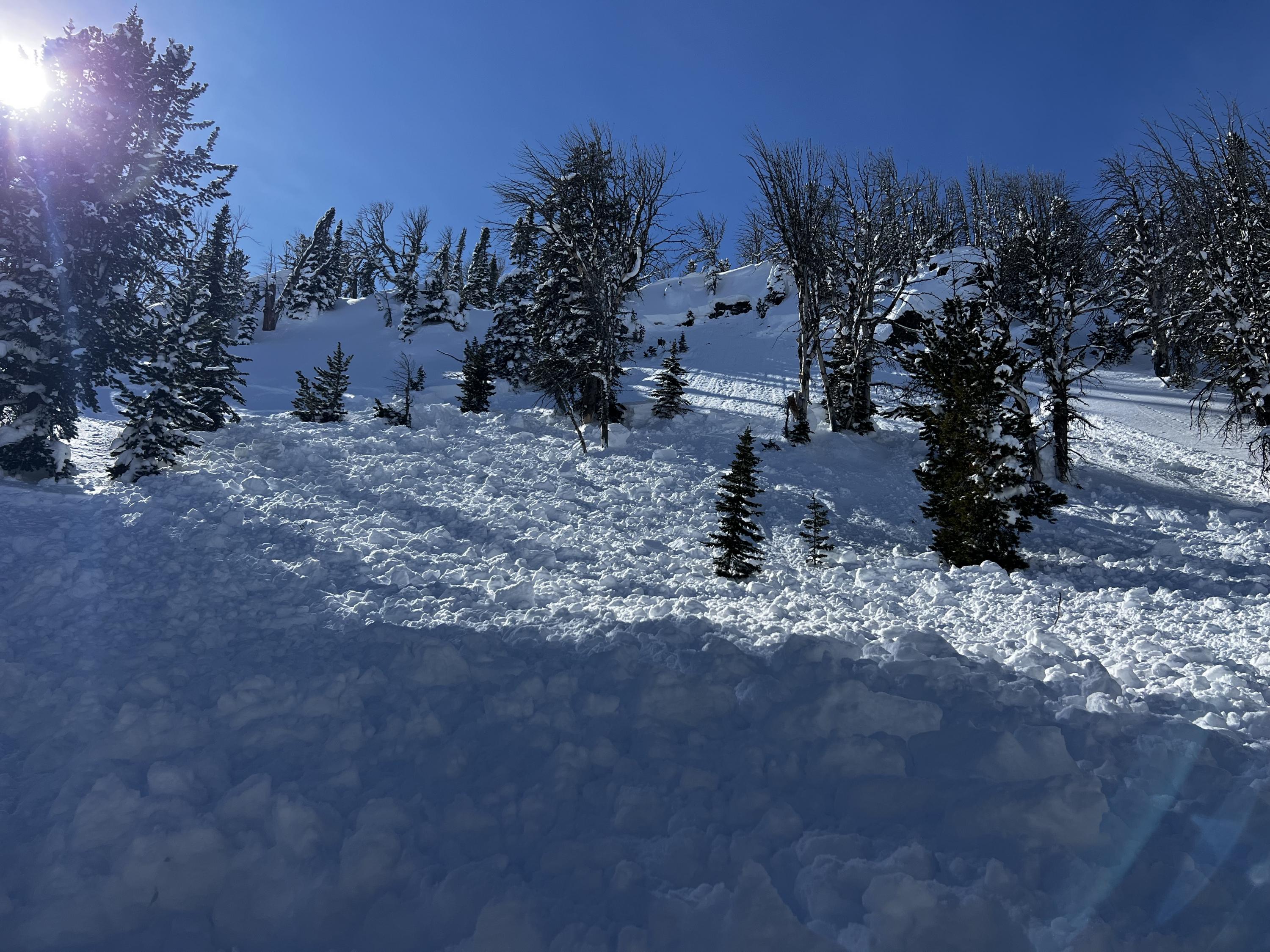
Snowmobile triggered avalanche in Teepee Basin.
-
Large cornice fall triggered avalanche in Sage Creek, Photo: GNFAC
-

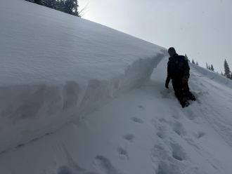
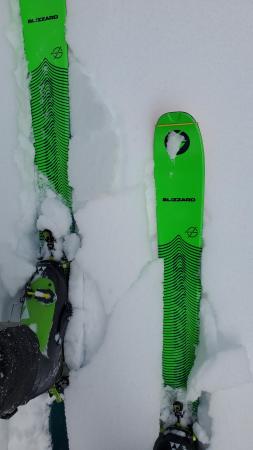
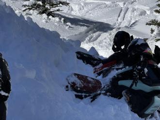
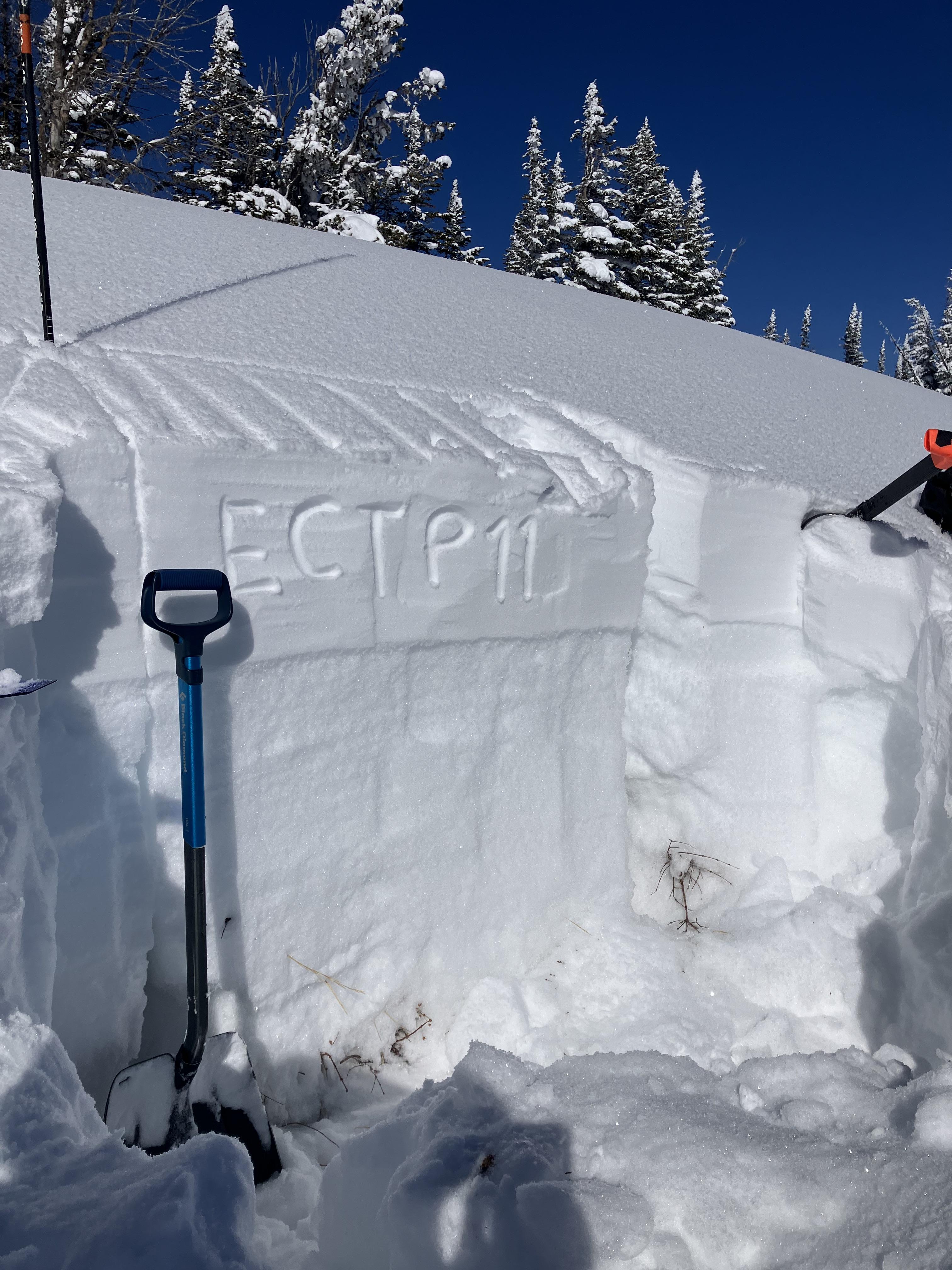
This snowpit on a SE aspect was made up of a dense slab of recent snow, sitting on top of many different layers of junky, faceted grains. Propagation was easy to find (ECTP 11, HS: 112). Photo: GNFAC
-
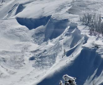
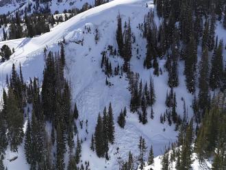
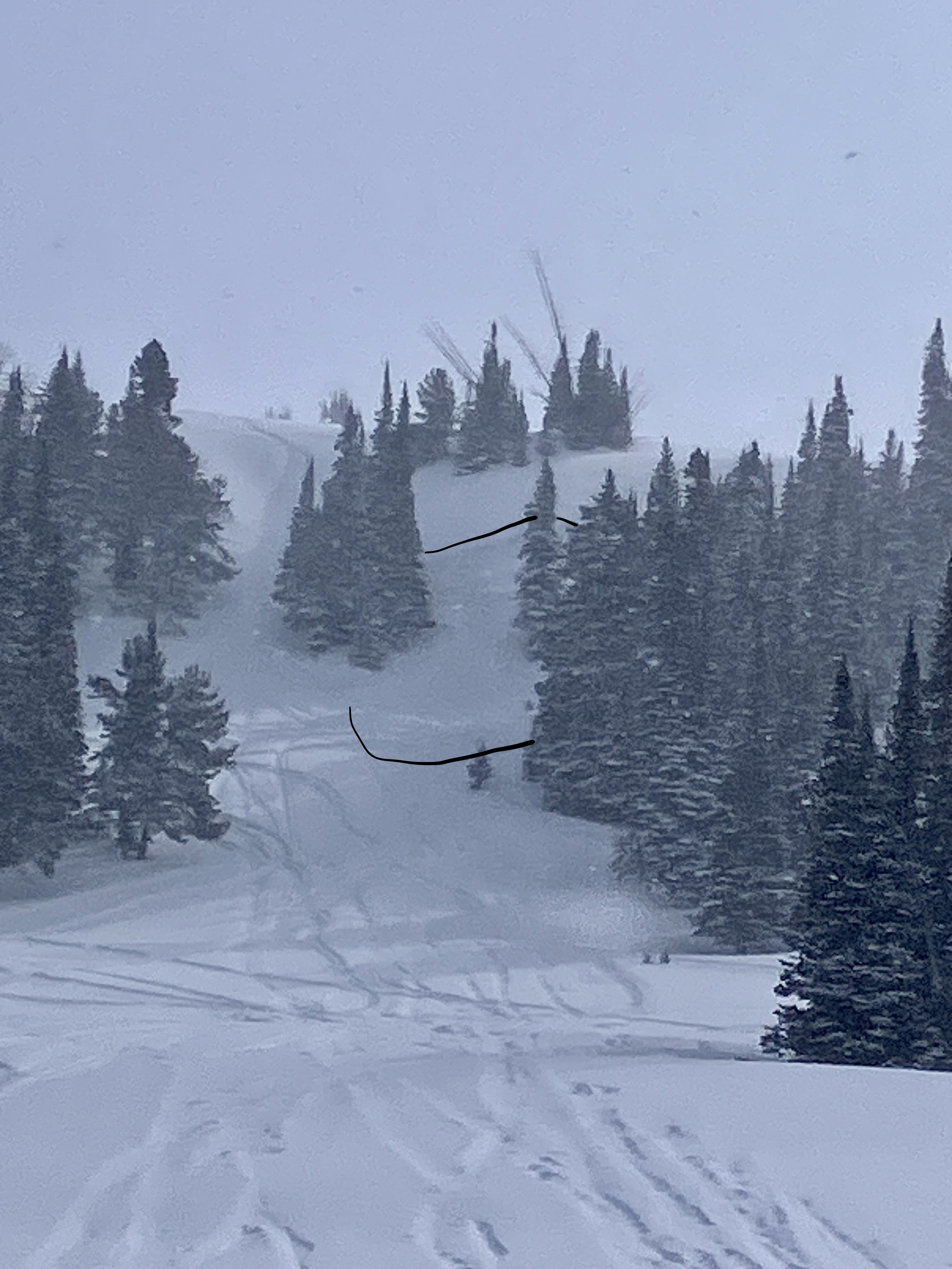
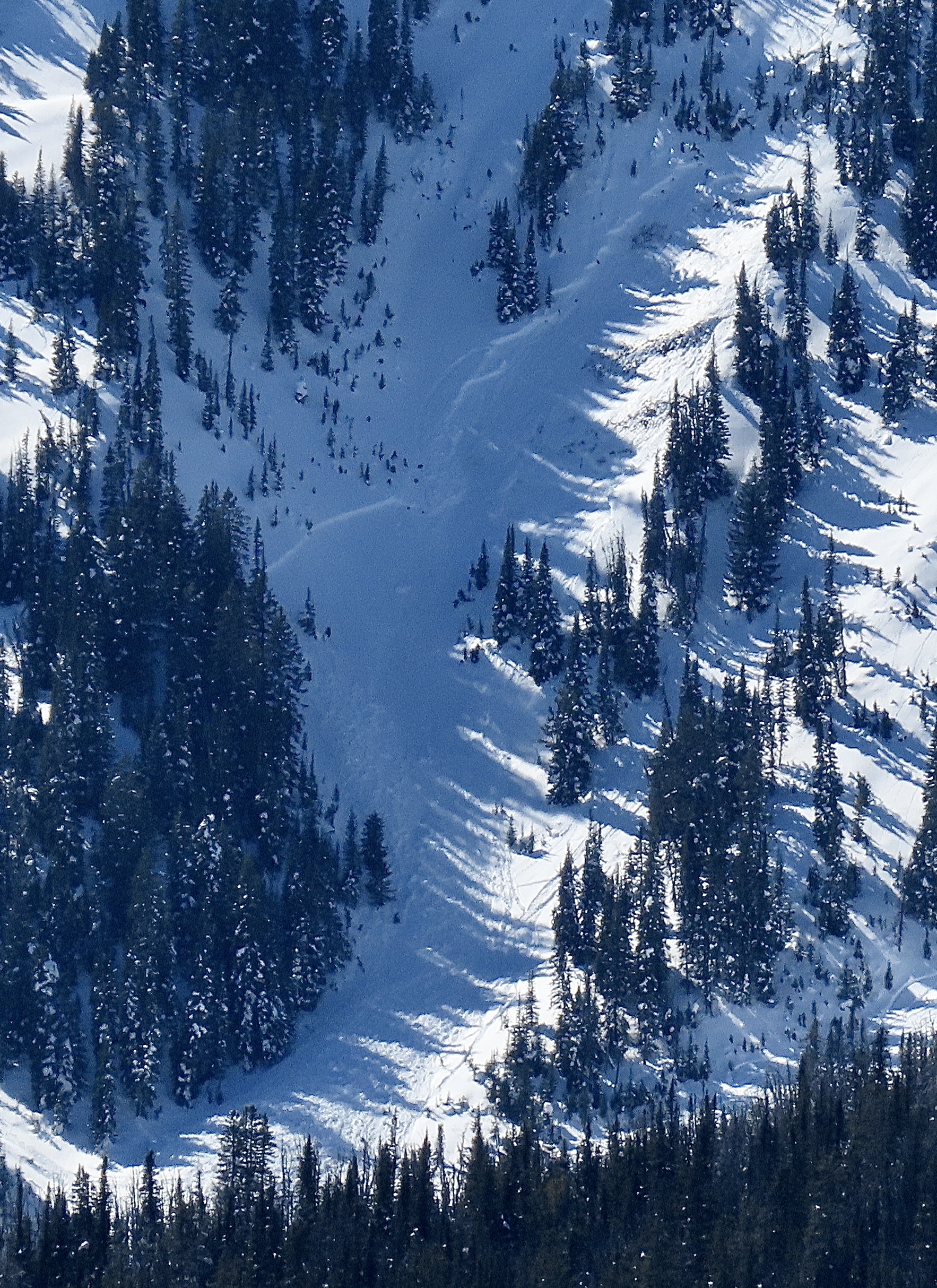
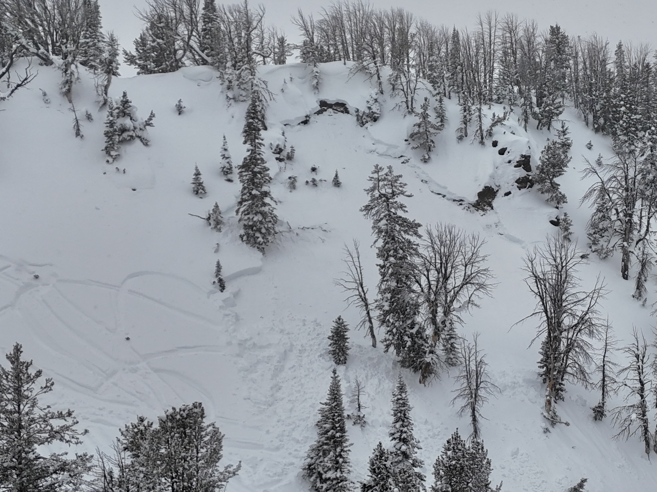
We saw up to five recent avalanches from the last few days. 1-2 looked to have failed on PWLs, and the rest were wind slabs. Cornice collapses triggered at least two of these avalanches. Photo: GNFAC


Videos- Southern Madison
WebCams
Raynolds Pass, Looking N
Weather Stations- Southern Madison
Weather Forecast Southern Madison
Extended Forecast for20 Miles S Big Sky MT
This Afternoon

High: 62 °F
Slight Chance
T-stormsTonight
Low: 44 °F
Slight Chance
T-storms then
Mostly ClearMonday

High: 65 °F
Sunny
Monday Night

Low: 48 °F
Mostly Clear
Tuesday
High: 70 °F
Sunny
Tuesday Night

Low: 49 °F
Partly Cloudy
Wednesday
High: 70 °F
Sunny
Wednesday Night
Low: 47 °F
Slight Chance
T-storms then
Partly CloudyThursday

High: 61 °F
Chance
Showers
The Last Word
We ended our 35th winter in operation after 141 forecasts and ZERO avalanche fatalities, the second winter in a row with no avalanche deaths. The last time this happened was 1988 and 1989. It’s been an incredible season.
Thank you for all your support! Our success is directly related to support from our community and the Forest Service. Thanks to the readers of the forecast, everyone that sent in observations, took an avalanche class, or donated money, time or gear. Have a safe spring and summer!